

On Wednesday, September 3, heavy rains combined with hail, lightning, and thunder impacted parts of Dubai, reflecting the country’s current changing weather patterns.
Footage from areas near Hatta shows severe rainfall drenching roads, causing water overflow and reduced visibility for motorists.
The UAE is presently under the influence of both surface and upper-level low-pressure systems extending from the south, coupled with the northward movement of the Intertropical Convergence Zone (ITCZ) towards the Emirates.
Stay informed with the latest updates. Follow KT on WhatsApp Channels.
This situation results in moist air masses moving from the Arabian Sea and the Sea of Oman towards the country, as per the NCM.
Videos shared by Storm Centre showcase hail, lightning, and heavy rains in Dubai’s Margham area. Watch the videos here:
View this post on Instagram
الامارات : الان هطول أمطار الخير على مرغم في دبي #مركز_العاصفة
3_9_2025 pic.twitter.com/wSRh55mb5H— مركز العاصفة (@Storm_centre) September 3, 2025
View this post on Instagram
Meanwhile, the National Centre of Meteorology has issued orange and yellow alerts, advising residents to be cautious of expected hazardous weather conditions, especially during outdoor activities.
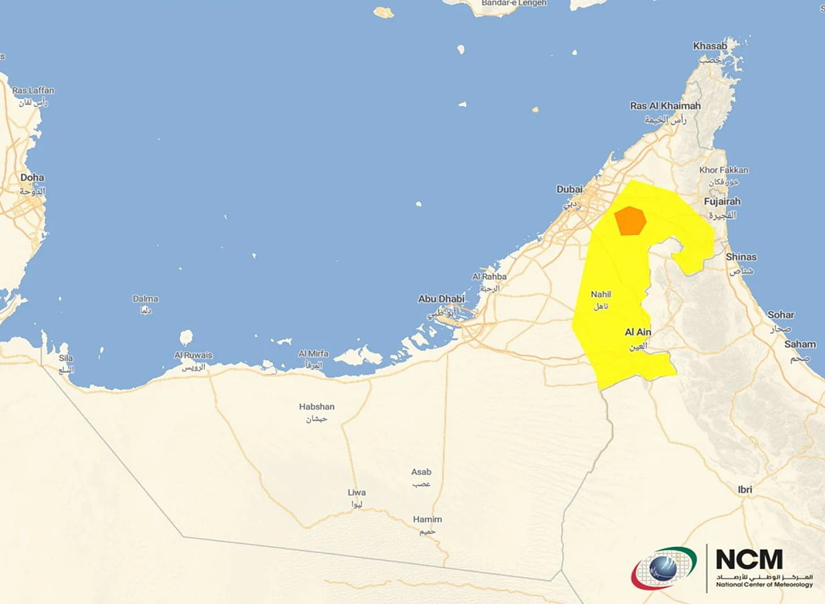
The rains are anticipated to continue until 8pm today, together with strong winds reaching speeds of 45 km/h, causing blowing dust and sand, reducing visibility, particularly in some eastern regions.
View this post on Instagram
Today’s highest temperature was 46.5°C in Sweihan (Al Ain) at 2.45pm, while the lowest was 22.9°C in Raknah (Al Ain) at 5.30am.
Residents should prepare for rainfall in some eastern and southern areas, extending to some interior regions until Friday, September 5.
Convective clouds forming with varying rainfall intensities, occasional lightning and thunder, and small hail are expected, particularly on Thursday.